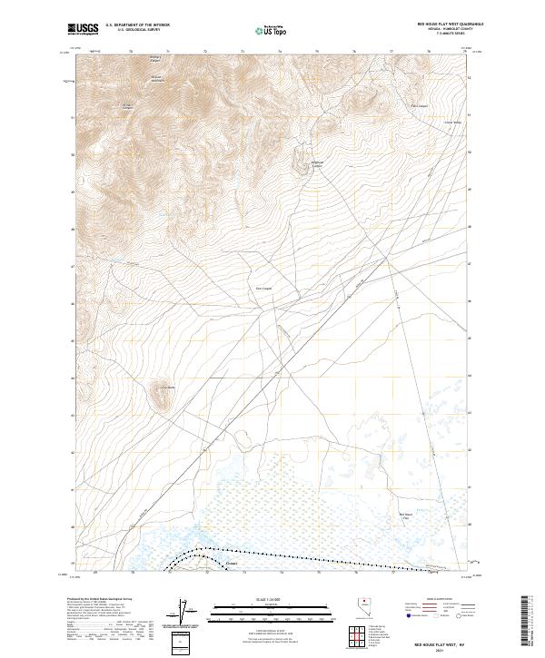
2021 Map of Red House Flat West
USGS Topo · Published 2021About this map
The Osgood Mountains dominate the northwestern horizon of this Nevada landscape, where the terrain transitions into the high desert floor of Red House Flat. This modern survey illustrates the enduring patterns of desert travel and water management, centered around life along the Humboldt River. Significant local landmarks include Lone Butte and the crossings of the mountains through Soldier Pass. The presence of Garden Spring and Dog Spring indicates the critical importance of reliable water sources in this arid environment. Ranching and transportation history is etched into the landscape via routes like Pettit Ranch Rd and Midas Rd, which connect the settlement of Comus to the surrounding canyons and flats. The map also delineates several named canyons, including Porphyry Canyon and Etchart Canyon, providing a comprehensive view of the local drainage and topography.
Find a feature on this map
27 named features on this map. Tap any name to fly to it.
Don’t see what you’re looking for? This feature index may not catch every label — zoom into the map to look around manually.
Map Details
Editions of this 2021 Red House Flat West Map
This is the sole edition of this map. No revisions or reprints were ever made.
Other maps of this area

1882 · Paradise
USGS Topo · 1:250,000

1893 · Paradise
USGS Topo · 1:250,000

1932 · Sonoma Range
USGS Topo · 1:250,000

1939 · Sonoma Range
USGS Topo · 1:250,000

1945 · Osgood Mountains
USGS Topo · 1:62,500

1947 · Osgood Mountains
USGS Topo · 1:62,500

1955 · McDermitt
USGS Topo · 1:250,000

1955 · Winnemucca
USGS Topo · 1:250,000

1958 · Winnemucca
USGS Topo · 1:250,000

1959 · McDermitt
USGS Topo · 1:250,000