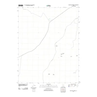
2011 Map of Red House Spring
USGS Topo · Published 2011About this map
Bannister Ruin stands as a focal point of human history in this high desert landscape, offering a window into the cultural heritage of San Juan County. The terrain is deeply incised by a network of drainages, where routes like Gulch Creek Rd and Red Canyon Rd navigate the spaces between complex landforms. Water sources, vital in this environment, are specifically marked at Red House Spring and Collins Spring, providing the essential context for why certain trails and landmarks emerged in these locations.
Find a feature on this map
13 named features on this map. Tap any name to fly to it.
Don’t see what you’re looking for? This feature index may not catch every label — zoom into the map to look around manually.
Map Details
Editions of this 2011 Red House Spring Map
This is the sole edition of this map. No revisions or reprints were ever made.
Other maps of this area

1886 · Henry Mountains
USGS Topo · 1:250,000

1892 · Henry Mountains
USGS Topo · 1:250,000

1952 · Mancos Mesa
USGS Topo · 1:62,500

1952 · Natural Bridges
USGS Topo · 1:62,500

1954 · White Canyon 3 SE
USGS Topo · 1:24,000

1954 · White Canyon 4 SE
USGS Topo · 1:24,000

1954 · White Canyon 4 SW
USGS Topo · 1:24,000

1954 · Clay Hills 2 NE
USGS Topo · 1:24,000

1954 · Clay Hills 2 SE
USGS Topo · 1:24,000

1954 · Clay Hills 1 NW
USGS Topo · 1:24,000