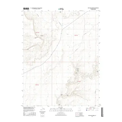
2017 Map of Red House Spring
USGS Topo · Published 2017About this map
Grand Gulch and its complex system of tributaries dominate this high desert landscape in San Juan County. Remote and characterized by deep drainages, the area relies on scattered water sources such as Red House Spring, Collins Spring, and Bannister Spring. The topography reveals a dramatic verticality, particularly evident at The Narrows and the Clay Hills, where the land drops sharply into carved basins. Primitive transportation routes like Red Canyon Rd and Gulch Creek Rd provide the only significant access through these canyons. This 2017 survey details the intersection of several township lines, including t38s r15e and t39s r16e, highlighting a region where natural features like Redman Canyon and Steer Pasture Canyon dictate the movement of both water and travelers.
Find a feature on this map
22 named features on this map. Tap any name to fly to it.
Don’t see what you’re looking for? This feature index may not catch every label — zoom into the map to look around manually.
Map Details
Editions of this 2017 Red House Spring Map
This is the sole edition of this map. No revisions or reprints were ever made.
Other maps of this area

1886 · Henry Mountains
USGS Topo · 1:250,000

1892 · Henry Mountains
USGS Topo · 1:250,000

1952 · Mancos Mesa
USGS Topo · 1:62,500

1952 · Natural Bridges
USGS Topo · 1:62,500

1954 · White Canyon 3 SE
USGS Topo · 1:24,000

1954 · White Canyon 4 SE
USGS Topo · 1:24,000

1954 · White Canyon 4 SW
USGS Topo · 1:24,000

1954 · Clay Hills 2 NE
USGS Topo · 1:24,000

1954 · Clay Hills 2 SE
USGS Topo · 1:24,000

1954 · Clay Hills 1 NW
USGS Topo · 1:24,000