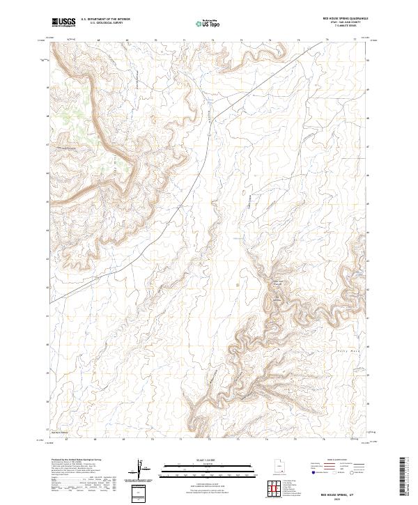
2023 Map of Red House Spring
USGS Topo · Published 2023About this map
Red House Spring sits at the heart of this high-elevation landscape in San Juan County, where natural water sources dictate the movement of travelers and cattle across the arid terrain. The drainage systems of Grand Gulch and Redman Canyon carve deep paths through the Red Rock Plateau, illustrating a complex network of canyons and mesas that have historically served as both barriers and vital corridors. Evidence of the region's ranching and transit history is preserved in the naming of features such as Steer Pasture Canyon and Steer Gulch, alongside primitive routes like Red Canyon Rd and Gulch Creek Rd. Significant landmarks including the Clay Hills and Polly Mesa dominate the horizon, while secluded water points like Collins Spring and Bannister Spring highlight the critical, sparse resources essential for survival in this portion of the Utah desert.
Find a feature on this map
19 named features on this map. Tap any name to fly to it.
Don’t see what you’re looking for? This feature index may not catch every label — zoom into the map to look around manually.
Map Details
Editions of this 2023 Red House Spring Map
This is the sole edition of this map. No revisions or reprints were ever made.
Other maps of this area

1886 · Henry Mountains
USGS Topo · 1:250,000

1892 · Henry Mountains
USGS Topo · 1:250,000

1952 · Mancos Mesa
USGS Topo · 1:62,500

1952 · Natural Bridges
USGS Topo · 1:62,500

1954 · White Canyon 3 SE
USGS Topo · 1:24,000

1954 · White Canyon 4 SE
USGS Topo · 1:24,000

1954 · White Canyon 4 SW
USGS Topo · 1:24,000

1954 · Clay Hills 2 NE
USGS Topo · 1:24,000

1954 · Clay Hills 2 SE
USGS Topo · 1:24,000

1954 · Clay Hills 1 NW
USGS Topo · 1:24,000