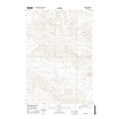
2017 Map of Red Knob
USGS Topo · Published 2017About this map
Red Knob rises as a prominent landmark amidst a highly dissected landscape of the eastern Montana rangelands. The terrain is defined by a complex network of seasonal drainages including Sheep Cr and Horse Cr, which have carved deep contours into the Custer County soil. This 2017 survey reveals a remote area where transportation is limited to established rural routes such as RD 403 and RD 420, facilitating movement between the various townships of t7n r52e and t6n r53e. The drainage patterns, including N Fork Horse Cr and Tub S Cr, demonstrate the intricate natural irrigation system of the region, vital for the grazing operations that historically dominated this part of the state.
Find a feature on this map
19 named features on this map. Tap any name to fly to it.
Don’t see what you’re looking for? This feature index may not catch every label — zoom into the map to look around manually.
Map Details
Editions of this 2017 Red Knob Map
This is the sole edition of this map. No revisions or reprints were ever made.
Other maps of this area

1953 · Miles City
USGS Topo · 1:250,000

1957 · Miles City
USGS Topo · 1:250,000

1958 · Miles City
USGS Topo · 1:250,000

1969 · Mizpah
USGS Topo · 1:24,000

1969 · Knowlton
USGS Topo · 1:24,000

1969 · Hogan Creek
USGS Topo · 1:24,000

1969 · Tepee Butte NE
USGS Topo · 1:24,000

1969 · Locate SE
USGS Topo · 1:24,000

1969 · Montague Butte
USGS Topo · 1:24,000
1969 · Pennock Creek
USGS Topo · 1:24,000