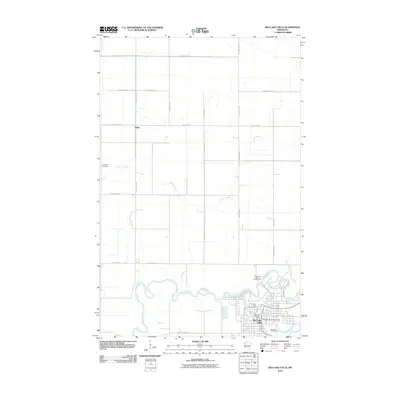
2010 Map of Red Lake Falls
USGS Topo · Published 2010About this map
The confluence of the Red Lake River and Clearwater River serves as the focal point for Red Lake Falls, where the town's residential grid is tucked into the northern bends of the waterway. This area of Red Lake County is defined by its deep river valleys cutting through a remarkably flat agricultural plateau, primarily organized by a rigid grid of county highways and section roads. In the town center, landmarks such as the Red Lake Falls Post Office and Red Lake County Fairgrounds are clearly delineated alongside public spaces like Riverside Park Campground.
Find a feature on this map
29 named features on this map. Tap any name to fly to it.
Don’t see what you’re looking for? This feature index may not catch every label — zoom into the map to look around manually.
Map Details
Editions of this 2010 Red Lake Falls Map
This is the sole edition of this map. No revisions or reprints were ever made.
Other maps of this area

1918 · Terrebonne
USGS Topo · 1:62,500

1918 · Red Lake Falls
USGS Topo · 1:62,500

1918 · Viking
USGS Topo · 1:62,500

1943 · Thief River Falls
USGS Topo · 1:62,500

1952 · Red Lake Falls
USGS Topo · 1:62,500

1952 · Grand Forks
USGS Topo · 1:250,000

1952 · Thief River Falls
USGS Topo · 1:250,000

1956 · Thief River Falls
USGS Topo · 1:250,000

1956 · Grand Forks
USGS Topo · 1:250,000

1957 · Thief River Falls
USGS Topo · 1:250,000
Featured Places
- Red Lake Falls, MN
- Wylie, MN
- Oaks Mobile Home Court, Red Lake Falls
- Pennington County, MN
- Red Lake County, MN