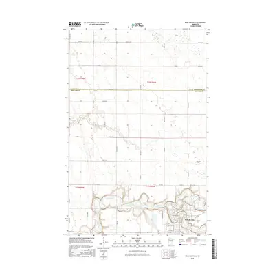
2016 Map of Red Lake Falls
USGS Topo · Published 2016About this map
The confluence of the Red Lake River and Clearwater River serves as the focal point of this 2016 survey, where the city of Red Lake Falls is situated on the river's winding banks. The terrain reflects the characteristic hydrology of the Red River Valley region, dominated by the intricate meanders of these two primary waterways and the smaller Browns Cr. The map captures the late 20th and early 21st-century rural landscape, marked by a precise grid of county roads such as Co RD 54 and Co HWY 12 that delineate agricultural sections. The small settlement of Wylie and the Immanuel Cem provide specific points of interest for genealogists tracing family roots in Red Lake and Pennington counties. This survey also documents the border between Pennington and Red Lake counties as it existed during this period.
Find a feature on this map
62 named features on this map. Tap any name to fly to it.
Don’t see what you’re looking for? This feature index may not catch every label — zoom into the map to look around manually.
Map Details
Editions of this 2016 Red Lake Falls Map
This is the sole edition of this map. No revisions or reprints were ever made.
Other maps of this area

1918 · Terrebonne
USGS Topo · 1:62,500

1918 · Red Lake Falls
USGS Topo · 1:62,500

1918 · Viking
USGS Topo · 1:62,500

1943 · Thief River Falls
USGS Topo · 1:62,500

1952 · Red Lake Falls
USGS Topo · 1:62,500

1952 · Grand Forks
USGS Topo · 1:250,000

1952 · Thief River Falls
USGS Topo · 1:250,000

1956 · Thief River Falls
USGS Topo · 1:250,000

1956 · Grand Forks
USGS Topo · 1:250,000

1957 · Thief River Falls
USGS Topo · 1:250,000
Featured Places
- Red Lake Falls, MN
- Wylie, MN
- Oaks Mobile Home Court, Red Lake Falls
- Pennington County, MN
- Red Lake County, MN