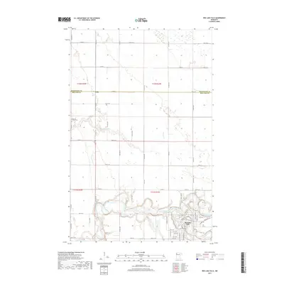
2019 Map of Red Lake Falls
USGS Topo · Published 2019About this map
The confluence of the Red Lake River and the Clearwater River serves as the focal point for this survey of Red Lake County. The city of Red Lake Falls is situated at this junction, showing a dense network of residential streets and infrastructure that follows the winding course of the two waterways. To the northwest, the smaller settlement of Wylie sits near the county line, connected by a grid of rural routes such as Co Rd 31 and Co Hwy 12. The landscape reflects a transition from the structured urban layout of the county seat to the agricultural expanse that defines the region. Cultural landmarks like the Immanuel Lutheran Cem are preserved in the rural sections, while the drainage of the land is managed through small tributaries like Browns Cr.
Find a feature on this map
65 named features on this map. Tap any name to fly to it.
Don’t see what you’re looking for? This feature index may not catch every label — zoom into the map to look around manually.
Map Details
Editions of this 2019 Red Lake Falls Map
This is the sole edition of this map. No revisions or reprints were ever made.
Other maps of this area

1918 · Terrebonne
USGS Topo · 1:62,500

1918 · Red Lake Falls
USGS Topo · 1:62,500

1918 · Viking
USGS Topo · 1:62,500

1943 · Thief River Falls
USGS Topo · 1:62,500

1952 · Red Lake Falls
USGS Topo · 1:62,500

1952 · Grand Forks
USGS Topo · 1:250,000

1952 · Thief River Falls
USGS Topo · 1:250,000

1956 · Thief River Falls
USGS Topo · 1:250,000

1956 · Grand Forks
USGS Topo · 1:250,000

1957 · Thief River Falls
USGS Topo · 1:250,000
Featured Places
- Red Lake Falls, MN
- Wylie, MN
- Oaks Mobile Home Court, Red Lake Falls
- Pennington County, MN
- Red Lake County, MN