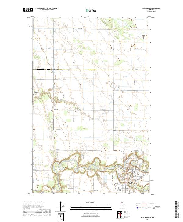
2022 Map of Red Lake Falls
USGS Topo · Published 2022About this map
Red Lake Falls serves as the focal point of this Northwest Minnesota survey, where the Red Lake River and Clearwater River converge in a series of sharp, winding bends. The topography is defined by the steep banks of these river valleys, which cut through the surrounding agricultural plains. The city's civic heart is marked by the Red Lake County Courthouse, surrounded by a dense grid of residential and commercial streets. To the northwest, the small settlement of Wylie sits along the Pennington and Red Lake County line, connected to the larger town by a network of rural routes like County Highway 12. Notable landmarks for local history include the Immanuel Lutheran Cem and the Red Lake River Trl, which follows the northern bank of the water. The landscape is also characterized by numerous small drainage features like Browns Cr and various wetlands scattered across the northern sections of the map.
Find a feature on this map
65 named features on this map. Tap any name to fly to it.
Don’t see what you’re looking for? This feature index may not catch every label — zoom into the map to look around manually.
Map Details
Editions of this 2022 Red Lake Falls Map
This is the sole edition of this map. No revisions or reprints were ever made.
Other maps of this area

1918 · Terrebonne
USGS Topo · 1:62,500

1918 · Red Lake Falls
USGS Topo · 1:62,500

1918 · Viking
USGS Topo · 1:62,500

1943 · Thief River Falls
USGS Topo · 1:62,500

1952 · Red Lake Falls
USGS Topo · 1:62,500

1952 · Grand Forks
USGS Topo · 1:250,000

1952 · Thief River Falls
USGS Topo · 1:250,000

1956 · Thief River Falls
USGS Topo · 1:250,000

1956 · Grand Forks
USGS Topo · 1:250,000

1957 · Thief River Falls
USGS Topo · 1:250,000
Featured Places
- Red Lake Falls, MN
- Wylie, MN
- Oaks Mobile Home Court, Red Lake Falls
- Pennington County, MN
- Red Lake County, MN