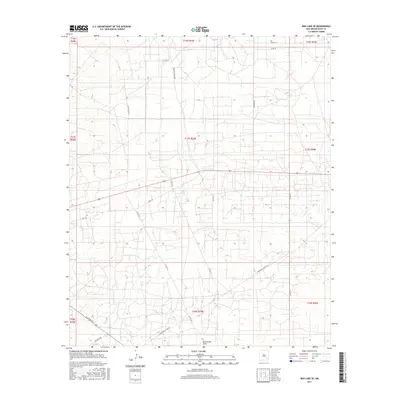
2017 Map of Red Lake SE
USGS Topo · Published 2017About this map
Bear Grass Draw winds through this section of Eddy County, defining the drainage patterns of a landscape marked by a dense network of local roads and survey lines. The late-2010s infrastructure reflects the region's continued development, with corridors like Hagerman Cutoff Rd and Arco Rd providing access to the interior sections of the Permian Basin. This survey illustrates the intricate Public Land Survey System grid, where township and range lines intersect with named routes such as Cowtown Rd and Bluestem Rd. The map is particularly useful for identifying the specific locations of historic ranching or industrial access points, including Barnaval Draw Rd and Old Loco Rd N, which highlight the intersection of geographic features and human transit in this New Mexico territory.
Find a feature on this map
26 named features on this map. Tap any name to fly to it.
Don’t see what you’re looking for? This feature index may not catch every label — zoom into the map to look around manually.
Map Details
Editions of this 2017 Red Lake SE Map
This is the sole edition of this map. No revisions or reprints were ever made.
Other maps of this area

1942 · Clayton Basin
USGS Topo · 1:62,500

1943 · Clayton Basin
USGS Topo · 1:62,500

1943 · Oil City
USGS Topo · 1:62,500

1951 · Diamond Mound
USGS Topo · 1:24,000

1953 · Basin Well
USGS Topo · 1:24,000

1954 · Carlsbad
USGS Topo · 1:250,000

1954 · Hobbs
USGS Topo · 1:250,000

1955 · Red Lake SE
USGS Topo · 1:24,000

1955 · Red Lake
USGS Topo · 1:24,000

1958 · Carlsbad
USGS Topo · 1:250,000