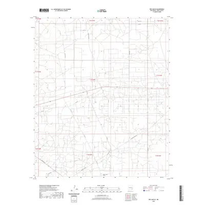
2020 Map of Red Lake SE
USGS Topo · Published 2020About this map
Bear Grass Draw meanders through this landscape in southeastern New Mexico, reflecting the arid hydrology of the Pecos Valley region. The map reveals an intricate network of local and county roads that support the area's industrial and ranching operations, including the Hagerman Cutoff Rd and the aptly named Cowtown Rd. Numerous smaller routes like Old Loco Rd N and Valley Gas Rd crisscross the township and range sections, suggesting a high density of utility and resource access points. This 2020 survey illustrates how modern infrastructure has overlaid the traditional western terrain, with routes like Arco Rd and Bluestem Rd providing access across the desert flats of Eddy County.
Find a feature on this map
25 named features on this map. Tap any name to fly to it.
Don’t see what you’re looking for? This feature index may not catch every label — zoom into the map to look around manually.
Map Details
Editions of this 2020 Red Lake SE Map
This is the sole edition of this map. No revisions or reprints were ever made.
Other maps of this area

1942 · Clayton Basin
USGS Topo · 1:62,500

1943 · Clayton Basin
USGS Topo · 1:62,500

1943 · Oil City
USGS Topo · 1:62,500

1951 · Diamond Mound
USGS Topo · 1:24,000

1953 · Basin Well
USGS Topo · 1:24,000

1954 · Carlsbad
USGS Topo · 1:250,000

1954 · Hobbs
USGS Topo · 1:250,000

1955 · Red Lake SE
USGS Topo · 1:24,000

1955 · Red Lake
USGS Topo · 1:24,000

1958 · Carlsbad
USGS Topo · 1:250,000