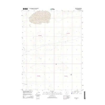
2015 Map of Red Lake
USGS Topo · Published 2015About this map
Red Lake and the high elevation of Chalk Butte define this portion of the Red Desert Basin in southern Wyoming. This high-altitude desert landscape is mapped with precise topography, showing a series of depressions and ridges that characterize the endorheic drainage systems of the region. The map documents the sparse infrastructure required for movement across this arid territory, where the primary routes include Bar X Rd, Black Rock Connector Rd, and Cr-20. The public land survey system grid, including t23n r97w and t22n r98w, provides the foundational structure for land management in this resource-rich but sparsely populated corner of Sweetwater County.
Find a feature on this map
10 named features on this map. Tap any name to fly to it.
Don’t see what you’re looking for? This feature index may not catch every label — zoom into the map to look around manually.
Map Details
Editions of this 2015 Red Lake Map
This is the sole edition of this map. No revisions or reprints were ever made.
Other maps of this area

1954 · Rock Springs
USGS Topo · 1:250,000

1955 · Lander
USGS Topo · 1:250,000

1958 · Lander
USGS Topo · 1:250,000

1958 · Rock Springs
USGS Topo · 1:250,000

1958 · Twelvemile Well
USGS Topo · 1:62,500

1958 · The Pinnacles
USGS Topo · 1:62,500

1960 · Red Lake
USGS Topo · 1:62,500

1960 · Five Fingers Butte
USGS Topo · 1:62,500

1961 · Lander
USGS Topo · 1:250,000

1962 · Rock Springs
USGS Topo · 1:250,000