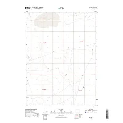
2017 Map of Red Lake
USGS Topo · Published 2017About this map
Red Lake dominates the northern landscape of this high-desert region within the Red Desert Basin. The terrain is characterized by its isolation and the vast, open expanses of Sweetwater County, where the elevation is subtly broken by landforms such as Chalk Butte. This area serves as a significant window into the arid geography of the Great Divide Basin, where internal drainage patterns create unique seasonal water bodies. The network of county roads, including Co Rd 4-20 and Co Rd 21, provides the only primary access through the grid-patterned sections of the Public Land Survey System. These routes highlight the sparse, utility-focused human imprint on a landscape primarily defined by its natural topography and remote basin environment.
Find a feature on this map
11 named features on this map. Tap any name to fly to it.
Don’t see what you’re looking for? This feature index may not catch every label — zoom into the map to look around manually.
Map Details
Editions of this 2017 Red Lake Map
This is the sole edition of this map. No revisions or reprints were ever made.
Other maps of this area

1954 · Rock Springs
USGS Topo · 1:250,000

1955 · Lander
USGS Topo · 1:250,000

1958 · Lander
USGS Topo · 1:250,000

1958 · Rock Springs
USGS Topo · 1:250,000

1958 · Twelvemile Well
USGS Topo · 1:62,500

1958 · The Pinnacles
USGS Topo · 1:62,500

1960 · Red Lake
USGS Topo · 1:62,500

1960 · Five Fingers Butte
USGS Topo · 1:62,500

1961 · Lander
USGS Topo · 1:250,000

1962 · Rock Springs
USGS Topo · 1:250,000