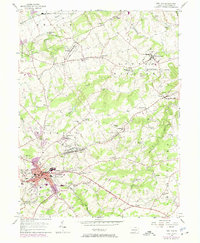
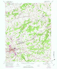
1953 Map of Red Lion
USGS Topo · Published 1975About this map
Red Lion serves as the industrial and residential hub of this York County landscape, where the Penn Central rail line cuts through the borough near the Nebinger Sch and local high school. The terrain is defined by the steep rise of Mt Pisgah to the north and the winding course of Cabin Creek and Fishing Creek through the townships of Windsor and Chanceford. Significant updates in purple reveal the suburban expansion of Pleasant View and Windsor borough as the region transitioned in the mid-20th century.
Find a feature on this map
75 named features on this map. Tap any name to fly to it.
Don’t see what you’re looking for? This feature index may not catch every label — zoom into the map to look around manually.
Map Details
Editions of this 1953 Red Lion Map
5 editions found
Other maps of this area

1902 · Lancaster
USGS Topo · 1:62,500

1904 · Lancaster
USGS Topo · 1:62,500

1908 · Middletown
USGS Topo · 1:62,500

1908 · York
USGS Topo · 1:62,500

1910 · York
USGS Topo · 1:62,500

1912 · Mc Calls Ferry
USGS Topo · 1:62,500

1943 · Lancaster
USGS Topo · 1:62,500

1943 · Middletown
USGS Topo · 1:62,500

1943 · Mc Calls Ferry
USGS Topo · 1:62,500

1948 · Baltimore
USGS Topo · 1:250,000