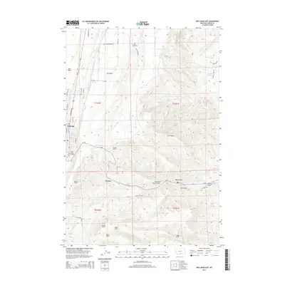
2014 Map of Red Lodge East
USGS Topo · Published 2014About this map
Red Lodge and its eastern surroundings are defined by a complex irrigation network and high benchlands in this contemporary topographic study. The landscape transitions from the residential streets of the county seat, where Rock Creek Bridge crosses the water, to the agricultural plateaus of West Bench and East Bench. An extensive system of man-made waterways, including the Pleasant Valley Canal and Rock Cr Clear Cr Ditch, highlights the area's long-standing reliance on diverted mountain runoff to support ranching and farming. To the southeast, the former coal-mining settlements of Washoe and Bearcreek sit along MT-308, where deep drainages like Foster Gulch and McCarty Gulch cut into the rising terrain. For those researching the region's heritage, the map identifies the Bearcreek Cem and Clear Creek Cem, which serve as physical links to the early twentieth-century communities that thrived here.
Find a feature on this map
57 named features on this map. Tap any name to fly to it.
Don’t see what you’re looking for? This feature index may not catch every label — zoom into the map to look around manually.
Map Details
Editions of this 2014 Red Lodge East Map
This is the sole edition of this map. No revisions or reprints were ever made.
Other maps of this area

1932 · Red Lodge No 2
USGS Topo · 1:48,000

1932 · Red Lodge No 1
USGS Topo · 1:48,000

1944 · Red Lodge
USGS Topo · 1:62,500

1954 · Billings
USGS Topo · 1:250,000

1956 · Roberts
USGS Topo · 1:24,000

1956 · Mount Maurice
USGS Topo · 1:62,500

1956 · Castagne
USGS Topo · 1:24,000

1956 · The Big Slide
USGS Topo · 1:24,000

1957 · Billings
USGS Topo · 1:250,000

1958 · Billings
USGS Topo · 1:250,000