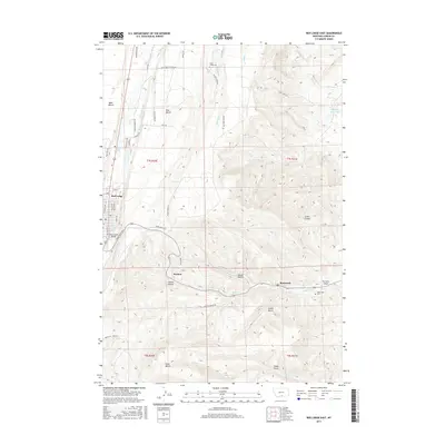
2017 Map of Red Lodge East
USGS Topo · Published 2017About this map
Red Lodge and the neighboring settlements of Washoe and Bearcreek anchor this portion of Carbon County, Montana, revealing a landscape defined by water management and high-plains agriculture. The eastern edge of Red Lodge sits along Rock Creek, where the Rock Creek Bridge provides a key crossing. To the north and east, the map traces an extensive network of irrigation infrastructure necessary for life on the benches, including the Clear Creek Ditch, Pleasant Valley Canal, and Cartwright Ditch.
Find a feature on this map
61 named features on this map. Tap any name to fly to it.
Don’t see what you’re looking for? This feature index may not catch every label — zoom into the map to look around manually.
Map Details
Editions of this 2017 Red Lodge East Map
This is the sole edition of this map. No revisions or reprints were ever made.
Other maps of this area

1932 · Red Lodge No 2
USGS Topo · 1:48,000

1932 · Red Lodge No 1
USGS Topo · 1:48,000

1944 · Red Lodge
USGS Topo · 1:62,500

1954 · Billings
USGS Topo · 1:250,000

1956 · Roberts
USGS Topo · 1:24,000

1956 · Mount Maurice
USGS Topo · 1:62,500

1956 · Castagne
USGS Topo · 1:24,000

1956 · The Big Slide
USGS Topo · 1:24,000

1957 · Billings
USGS Topo · 1:250,000

1958 · Billings
USGS Topo · 1:250,000