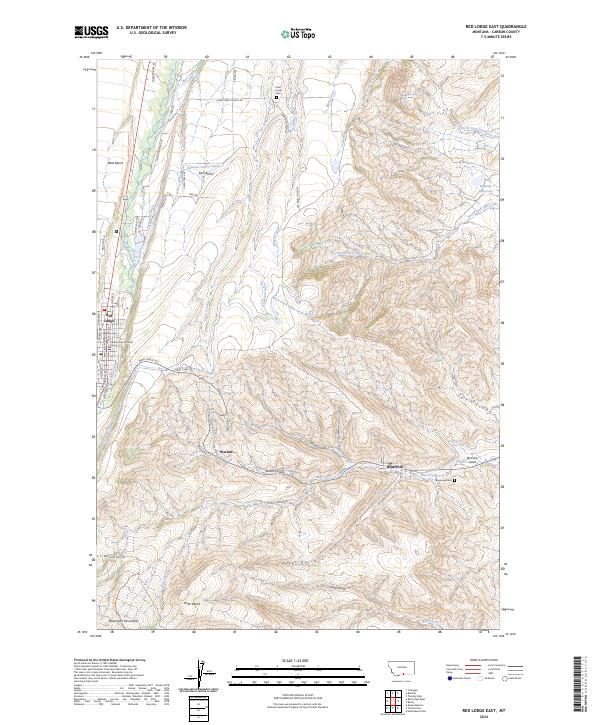
2024 Map of Red Lodge East
USGS Topo · Published 2024About this map
Red Lodge serves as the focal point of this Carbon County landscape, where the eastern slopes of the Beartooth Mountains meet a complex network of agricultural irrigation and high plateau benches. The settlement pattern follows the contours of the land, with Washoe and Bearcreek situated along the drainage of Bear Creek. Local history is deeply embedded in the terrain, from the Carbon County Court House in the regional center to the rural Clear Creek Cem and Bearcreek Cem. The map reveals a sophisticated water management system vital to the region's ranching, including the Pleasant Valley Canal, Sparr Ditch, and Jeffrey Ditch, which crisscross the flat expanses of West Bench and East Bench. Named coulees and gulches like Scotch Coulee and McCarty Gulch define the drainage patterns that have shaped movement and land use for generations.
Find a feature on this map
46 named features on this map. Tap any name to fly to it.
Don’t see what you’re looking for? This feature index may not catch every label — zoom into the map to look around manually.
Map Details
Editions of this 2024 Red Lodge East Map
This is the sole edition of this map. No revisions or reprints were ever made.
Other maps of this area

1932 · Red Lodge No 2
USGS Topo · 1:48,000

1932 · Red Lodge No 1
USGS Topo · 1:48,000

1944 · Red Lodge
USGS Topo · 1:62,500

1954 · Billings
USGS Topo · 1:250,000

1956 · Roberts
USGS Topo · 1:24,000

1956 · Mount Maurice
USGS Topo · 1:62,500

1956 · Castagne
USGS Topo · 1:24,000

1956 · The Big Slide
USGS Topo · 1:24,000

1957 · Billings
USGS Topo · 1:250,000

1958 · Billings
USGS Topo · 1:250,000