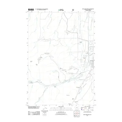
2011 Map of Red Lodge West
USGS Topo · Published 2011About this map
Red Lodge and its western outskirts are documented here at a time of significant recreational development and resource extraction. The landscape is defined by the steep transition from the high peaks of Nichols Peak and Grizzly Peak down to the valley floor. High-altitude leisure dominates the western slopes at the Red Lodge Mountain Ski Area, while the industrial history of the region is anchored by the Willow Creek Number 1 Mine. Below the Limestone Palisades, the drainage of Willow Creek and West Fork Rock Creek supports a network of campgrounds and trails, including Palisades Campground and Wild Bill Lake Campground. Residential expansion is visible along the foothills in the Timbercrest area, while the town's essential infrastructure, such as the Red Lodge Airport and Red Lodge Cemetery, occupies the more level terrain to the east near Spring Creek.
Find a feature on this map
71 named features on this map. Tap any name to fly to it.
Don’t see what you’re looking for? This feature index may not catch every label — zoom into the map to look around manually.
Map Details
Editions of this 2011 Red Lodge West Map
This is the sole edition of this map. No revisions or reprints were ever made.
Other maps of this area

1932 · Red Lodge No 2
USGS Topo · 1:48,000

1932 · Red Lodge No 1
USGS Topo · 1:48,000

1944 · Red Lodge
USGS Topo · 1:62,500

1954 · Billings
USGS Topo · 1:250,000

1956 · Roscoe
USGS Topo · 1:24,000

1956 · Roberts
USGS Topo · 1:24,000

1956 · Mount Maurice
USGS Topo · 1:62,500

1956 · Castagne
USGS Topo · 1:24,000

1957 · Billings
USGS Topo · 1:250,000

1958 · Billings
USGS Topo · 1:250,000