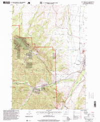
1996 Map of Red Lodge West
USGS Topo · Published 1999About this map
Red Lodge serves as the gateway to the high elevations of the Custer National Forest in this mid-1990s revision. The transition from the developed valley to the alpine landscape is marked by the Red Lodge Mountain Ski Area and the Touring National Recreation Trail, which wind through the complex drainages of Nichols Creek and Silver Run Creek. The town's layout includes civic and recreation sites like the Rodeo Ground, an Airport, and the local Cem. Outside the main settlement, rural infrastructure is visible via the Draper School and the Beartooth Work Center near the West Fork Rock Creek. The landscape is dominated by massive geological features, most notably the Limestone Palisades and Grizzly Peak, while the northern reaches feature the prominent West Bench above Spring Creek.
Find a feature on this map
42 named features on this map. Tap any name to fly to it.
Don’t see what you’re looking for? This feature index may not catch every label — zoom into the map to look around manually.
Map Details
Editions of this 1996 Red Lodge West Map
This is the sole edition of this map. No revisions or reprints were ever made.
Other maps of this area

1932 · Red Lodge No 2
USGS Topo · 1:48,000

1932 · Red Lodge No 1
USGS Topo · 1:48,000

1944 · Red Lodge
USGS Topo · 1:62,500

1954 · Billings
USGS Topo · 1:250,000

1956 · Roscoe
USGS Topo · 1:24,000

1956 · Roberts
USGS Topo · 1:24,000

1956 · Mount Maurice
USGS Topo · 1:62,500

1956 · Castagne
USGS Topo · 1:24,000

1957 · Billings
USGS Topo · 1:250,000

1958 · Billings
USGS Topo · 1:250,000