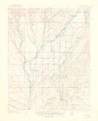
1913 Map of Red Mesa
USGS Topo · Published 1949About this map
The high plateau of Red Mesa in La Plata County defines a landscape of early 20th-century agriculture and ranching, heavily dependent on the management of water through systems like the Pruett Ditch and McDermott Ditch. The agricultural settlements of Kline and Redmesa serve as the primary hubs, with the Mormon Church providing a central landmark for the local community. The mapping of the South Boundary Ute Ceded Land running across the northern portion of the sheet reflects the era's complex history of land tenure and the relocation of indigenous territories. Transportation and industry are anchored by the Rio Grande Southern RR and the Fort Lewis Sta in the northeast, while numerous gulches such as Alkali Gulch and Rattlesnake Gulch carry seasonal flows toward the La Plata River. The presence of several educational institutions, including the Rockville School and Bruiser School, underscores the distributed nature of the rural population during this period.
Find a feature on this map
39 named features on this map. Tap any name to fly to it.
Don’t see what you’re looking for? This feature index may not catch every label — zoom into the map to look around manually.
Map Details
Editions of this 1913 Red Mesa Map
4 editions found

Other maps of this area

1889 · Largo
USGS Topo · 1:250,000

1889 · Chaco
USGS Topo · 1:250,000

1892 · Chaco
USGS Topo · 1:250,000

1895 · Largo
USGS Topo · 1:250,000

1895 · La Plata
USGS Topo · 1:62,500

1897 · La Plata
USGS Topo · 1:62,500

1898 · Durango
USGS Topo · 1:62,500

1899 · La Plata
USGS Topo · 1:62,500

1907 · Durango
USGS Topo · 1:62,500

1908 · Ignacio
USGS Topo · 1:125,000