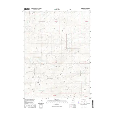
2015 Map of Red Mountain
USGS Topo · Published 2015About this map
Medicine Bow National Forest encompasses this high-altitude landscape in the Sierra Madre range, where the Continental Divide dictates the flow of numerous headwaters. The Continental Divide National Scenic Trail winds through the western half of the map, crossing Battle Pass and skirting prominent peaks like Red Mtn and Doane Peak.
Find a feature on this map
36 named features on this map. Tap any name to fly to it.
Don’t see what you’re looking for? This feature index may not catch every label — zoom into the map to look around manually.
Map Details
Editions of this 2015 Red Mountain Map
This is the sole edition of this map. No revisions or reprints were ever made.
Other maps of this area

1932 · Savery
USGS Topo · 1:96,000

1939 · Saratoga
USGS Topo · 1:125,000

1940 · Savery
USGS Topo · 1:125,000

1954 · Rawlins
USGS Topo · 1:250,000

1958 · Rawlins
USGS Topo · 1:250,000

1961 · Red Mountain
USGS Topo · 1:24,000

1961 · Bridger Peak
USGS Topo · 1:24,000

1961 · Encampment
USGS Topo · 1:24,000
1961 · Dudley Creek
USGS Topo · 1:24,000
1961 · Cow Creek Ranch
USGS Topo · 1:24,000