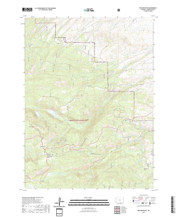
2021 Map of Red Mountain
USGS Topo · Published 2021About this map
Sierra Madre peaks and the high-elevation drainage of the N Fork Encampment River define this portion of the Medicine Bow National Forest in the early 21st century. The map centers on the high-altitude transit of Battle Pass, a critical crossing point where the Continental Divide intersects regional routes. This landscape is shaped by deep glacial and water-carved features such as Hidden Treasure Gulch, Slaughterhouse Gulch, and Tram Gulch. Water resources are prominent throughout the terrain, ranging from the Cow Cr Reservoir to numerous alpine streams like Nellie Cr and Teddy Cr. The area is a hub for high-country recreation, evidenced by the Bottle Creek C.G. and extensive networks including the Bottle Creek Ski Trails Trl and the Continental Divide National Scenic Trl.
Find a feature on this map
43 named features on this map. Tap any name to fly to it.
Don’t see what you’re looking for? This feature index may not catch every label — zoom into the map to look around manually.
Map Details
Editions of this 2021 Red Mountain Map
This is the sole edition of this map. No revisions or reprints were ever made.
Other maps of this area

1932 · Savery
USGS Topo · 1:96,000

1939 · Saratoga
USGS Topo · 1:125,000

1940 · Savery
USGS Topo · 1:125,000

1954 · Rawlins
USGS Topo · 1:250,000

1958 · Rawlins
USGS Topo · 1:250,000

1961 · Red Mountain
USGS Topo · 1:24,000

1961 · Bridger Peak
USGS Topo · 1:24,000

1961 · Encampment
USGS Topo · 1:24,000
1961 · Dudley Creek
USGS Topo · 1:24,000
1961 · Cow Creek Ranch
USGS Topo · 1:24,000