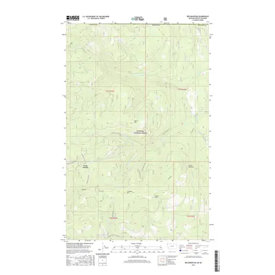
2017 Map of Red Mountain
USGS Topo · Published 2017About this map
Kootenai National Forest dominates this landscape within the Purcell Mountains along the Montana and British Columbia border. This survey captures a rugged network of drainage systems and high-elevation peaks, including Red Mtn, Marias Mtn, and Clingback Mtn. The terrain is defined by a dense system of Forest Service access points such as Natl Forest Develop Road 596 Rd and the Dodge Summit Trail, which facilitates movement through the steep corridors of Dodge Summit. Researchers will find a preserved wilderness environment where numerous tributaries like Young Cr, Sullivan Cr, and Dodge Cr descend from the heights, illustrating the complex watershed management within Lincoln Co during the early 21st century. The map provides precise detail for those tracing natural landmarks, from the small Fourmile Spring to the broader expanse of Simons Draw.
Find a feature on this map
33 named features on this map. Tap any name to fly to it.
Don’t see what you’re looking for? This feature index may not catch every label — zoom into the map to look around manually.
Map Details
Editions of this 2017 Red Mountain Map
This is the sole edition of this map. No revisions or reprints were ever made.
Other maps of this area

1957 · Kalispell
USGS Topo · 1:250,000

1960 · Kalispell
USGS Topo · 1:250,000

1961 · Kalispell
USGS Topo · 1:250,000

1963 · Rexford
USGS Topo · 1:24,000

1963 · Robinson Mountain
USGS Topo · 1:24,000

1963 · Red Mountain
USGS Topo · 1:24,000

1963 · Webb Mountain
USGS Topo · 1:24,000

1963 · Boulder Lakes
USGS Topo · 1:24,000
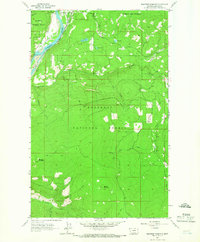
1963 · Beartrap Mountain
USGS Topo · 1:24,000

1979 · Yaak River
USGS Topo · 1:100,000