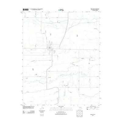
2012 Map of Red Oak
USGS Topo · Published 2012About this map
Red Oak serves as the central hub of this eastern Oklahoma landscape, positioned north of the winding Fourche Maline. The topography is defined by significant elevations including Red Oak Mtn, Red Oak Peak, and Bull Hill, which overlook a network of creek drainages such as Brazil Cr and Red Oak Cr. For genealogists and local historians, the map provides precise locations for several burial grounds, including Red Oak Cem, Rock Creek Cem, and Salonia Cem. The southern portion of the quadrangle transitions from the higher ridges down to the broad Long Prairie, while the small settlement of Denman sits further east. This 2012 survey by the U.S. Geological Survey captures the rural road network and the natural watercourses that have historically shaped settlement patterns in Latimer County.
Find a feature on this map
58 named features on this map. Tap any name to fly to it.
Don’t see what you’re looking for? This feature index may not catch every label — zoom into the map to look around manually.
Map Details
Editions of this 2012 Red Oak Map
This is the sole edition of this map. No revisions or reprints were ever made.
Other maps of this area

1900 · Sansbois
USGS Topo · 1:125,000

1900 · Sallisaw
USGS Topo · 1:125,000

1900 · Winding Stair
USGS Topo · 1:125,000

1901 · Tuskahoma
USGS Topo · 1:125,000

1908 · Tuskahoma
USGS Topo · 1:125,000

1909 · Tuskahoma
USGS Topo · 1:125,000

1909 · Winding Stair
USGS Topo · 1:125,000

1909 · Sans Bois
USGS Topo · 1:125,000

1911 · Sallisaw
USGS Topo · 1:125,000

1911 · Sansbois
USGS Topo · 1:125,000