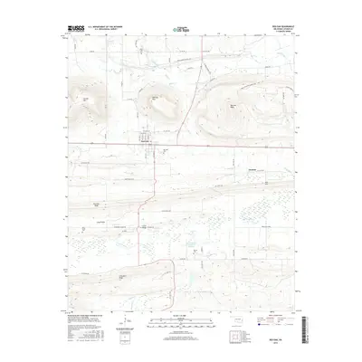
2016 Map of Red Oak
USGS Topo · Published 2016About this map
Red Oak serves as the central hub of this Latimer County landscape, where the flat expanse of Long Prairie meets a series of prominent ridges and peaks. To the north, the terrain rises sharply into Red Oak Mtn and Red Oak Peak, while Brazil Creek winds through the northern lowlands. Local history is preserved in several burial grounds, including Red Oak Cem, Rock Creek Cem, and Salonia Cem, which anchor the surrounding rural communities.
Find a feature on this map
69 named features on this map. Tap any name to fly to it.
Don’t see what you’re looking for? This feature index may not catch every label — zoom into the map to look around manually.
Map Details
Editions of this 2016 Red Oak Map
This is the sole edition of this map. No revisions or reprints were ever made.
Other maps of this area

1900 · Sansbois
USGS Topo · 1:125,000

1900 · Sallisaw
USGS Topo · 1:125,000

1900 · Winding Stair
USGS Topo · 1:125,000

1901 · Tuskahoma
USGS Topo · 1:125,000

1908 · Tuskahoma
USGS Topo · 1:125,000

1909 · Tuskahoma
USGS Topo · 1:125,000

1909 · Winding Stair
USGS Topo · 1:125,000

1909 · Sans Bois
USGS Topo · 1:125,000

1911 · Sallisaw
USGS Topo · 1:125,000

1911 · Sansbois
USGS Topo · 1:125,000