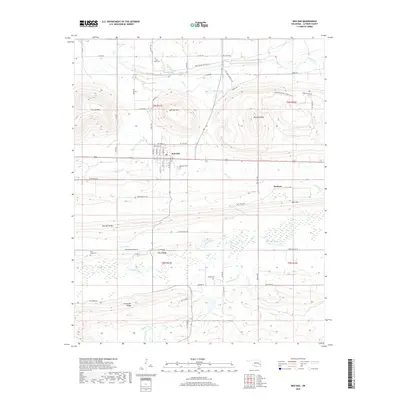
2018 Map of Red Oak
USGS Topo · Published 2018About this map
Red Oak serves as the central hub of this Latimer County landscape, where the grid of NW Maple St and S Main St meets the open terrain of Long Prairie. The topography is defined by the significant elevations of Red Oak Mtn and Red Oak Peak to the north, while the southern reaches descend toward the wetlands of Fourche Maline and Little Ridge. Genealogists and local historians will find several key burial sites documented, including Rock Creek Cem and Salonia Cem, which anchor the surrounding rural communities. The map details an extensive network of backroads and creek crossings, such as those along Brazil Creek and Turkey Cr, reflecting the region's ranching and residential patterns. From the height of Bull Hill to the banks of Hog Cr, the map provides a look at the enduring landmarks of this Oklahoma territory.
Find a feature on this map
72 named features on this map. Tap any name to fly to it.
Don’t see what you’re looking for? This feature index may not catch every label — zoom into the map to look around manually.
Map Details
Editions of this 2018 Red Oak Map
This is the sole edition of this map. No revisions or reprints were ever made.
Other maps of this area

1900 · Sansbois
USGS Topo · 1:125,000

1900 · Sallisaw
USGS Topo · 1:125,000

1900 · Winding Stair
USGS Topo · 1:125,000

1901 · Tuskahoma
USGS Topo · 1:125,000

1908 · Tuskahoma
USGS Topo · 1:125,000

1909 · Tuskahoma
USGS Topo · 1:125,000

1909 · Winding Stair
USGS Topo · 1:125,000

1909 · Sans Bois
USGS Topo · 1:125,000

1911 · Sallisaw
USGS Topo · 1:125,000

1911 · Sansbois
USGS Topo · 1:125,000