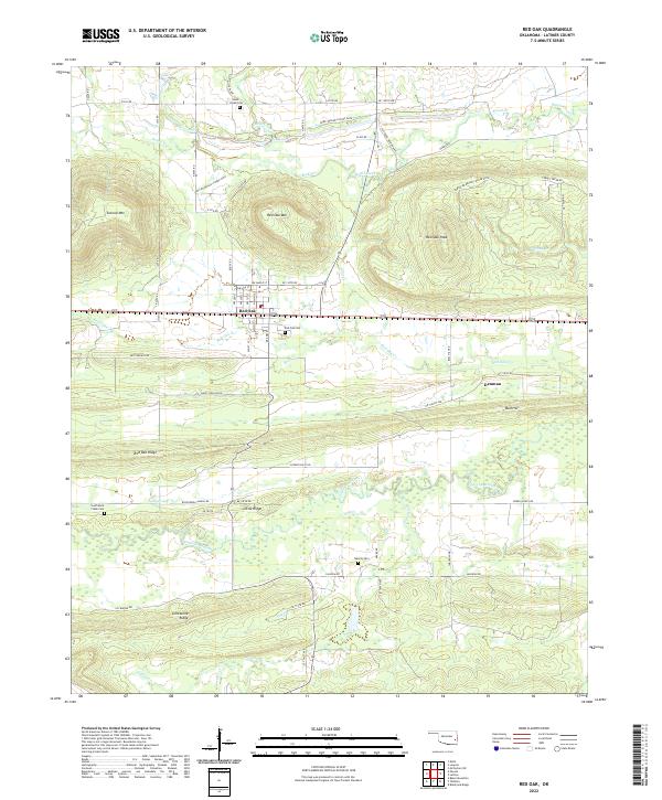
2022 Map of Red Oak
USGS Topo · Published 2022About this map
Red Oak serves as the central hub of this Latimer County landscape, where the town plan is nestled south of Red Oak Mtn and Second Mtn. The terrain is defined by prominent east-west ridges, including Limestone Ridge and Red Oak Ridge, which separate the various creek valleys. For genealogists, the map identifies several burial grounds such as Rock Creek Cem, South Rock Creek Cem, and Salonia Cem. Waterways like Fourche Maline and Brazil Cr drain the lowlands, while specialized infrastructure is noted by several stretches of PRD. Behind Locked Gate. Small settlements like Denman and local landmarks such as Bull Hill further clarify the historical footprint of this Oklahoma region.
Find a feature on this map
52 named features on this map. Tap any name to fly to it.
Don’t see what you’re looking for? This feature index may not catch every label — zoom into the map to look around manually.
Map Details
Editions of this 2022 Red Oak Map
This is the sole edition of this map. No revisions or reprints were ever made.
Other maps of this area

1900 · Sansbois
USGS Topo · 1:125,000

1900 · Sallisaw
USGS Topo · 1:125,000

1900 · Winding Stair
USGS Topo · 1:125,000

1901 · Tuskahoma
USGS Topo · 1:125,000

1908 · Tuskahoma
USGS Topo · 1:125,000

1909 · Tuskahoma
USGS Topo · 1:125,000

1909 · Winding Stair
USGS Topo · 1:125,000

1909 · Sans Bois
USGS Topo · 1:125,000

1911 · Sallisaw
USGS Topo · 1:125,000

1911 · Sansbois
USGS Topo · 1:125,000