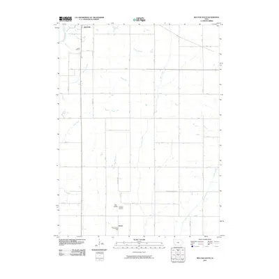
2010 Map of Red Oak South
USGS Topo · Published 2010About this map
Agricultural patterns in Montgomery County define this landscape south of Red Oak, where the East Nishnabotna River and Mormon Branch drain the northern reaches of the quadrangle. The settlement of Nyman sits in the southern portion of the sheet, serving as a localized point of interest amidst a grid of rural roads like Hickory Ave and L Ave. For those tracing family histories, the map includes several burial grounds, notably Hewitt Cemetery in the north and the clustered Plum Thicket Cemetery, Fremont Township Cemetery, and Mount Hope Cemetery further south. The drainage network is complex, featuring Ashby Creek, West Tarkio Creek, and Romp Creek, which eventually feed into the Tarkio River near the border of Montgomery Page St.
Find a feature on this map
35 named features on this map. Tap any name to fly to it.
Don’t see what you’re looking for? This feature index may not catch every label — zoom into the map to look around manually.
Map Details
Editions of this 2010 Red Oak South Map
This is the sole edition of this map. No revisions or reprints were ever made.
Other maps of this area

1954 · Omaha
USGS Topo · 1:250,000

1955 · Nebraska City
USGS Topo · 1:250,000

1957 · Nebraska City
USGS Topo · 1:250,000

1957 · Omaha
USGS Topo · 1:250,000

1958 · Omaha
USGS Topo · 1:250,000

1958 · Nebraska City
USGS Topo · 1:250,000

1978 · Stanton
USGS Topo · 1:24,000

1978 · Shenandoah East
USGS Topo · 1:24,000

1978 · Stanton SW
USGS Topo · 1:24,000

1978 · Wallin
USGS Topo · 1:24,000