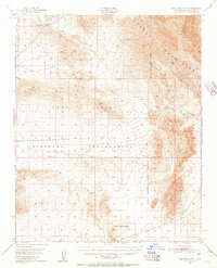
1948 Map of Red Pass Lake
USGS Topo · Published 1948About this map
Camp Irwin Military Reservation dominates this 1948 topographic landscape, reflecting the significant military expansion in the High Desert following World War II. The terrain is characterized by the formidable heights of the Ava Watz Mountains in the northeast, which contrast sharply with the dry lake beds found at lower elevations. Red Pass Lake and a portion of Silver Lake appear as prominent ephemeral water features, providing crucial geographic markers in an otherwise arid environment. This survey captures a moment when the area was transitionally managed by the Camp Irwin Military Reservation, showing a landscape primarily defined by its natural topography and military boundaries rather than civilian settlement. A small Cem label provides a rare point of human interest for genealogists tracing early activity in this remote corner of San Bernardino County.
Find a feature on this map
5 named features on this map. Tap any name to fly to it.
Don’t see what you’re looking for? This feature index may not catch every label — zoom into the map to look around manually.
Map Details
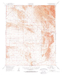
Editions of this 1948 Red Pass Lake Map
3 editions found
Other maps of this area

1933 · Avawatz Mountains
USGS Topo · 1:250,000

1947 · Trona
USGS Topo · 1:250,000

1948 · Red Pass Lake
USGS Topo · 1:62,500

1948 · Trona
USGS Topo · 1:250,000

1948 · Alvord Mountain
USGS Topo · 1:62,500

1948 · Cave Mountain
USGS Topo · 1:62,500

1948 · Leach Lake
USGS Topo · 1:62,500

1948 · Avawatz Pass
USGS Topo · 1:62,500

1948 · Tiefort Mountains
USGS Topo · 1:62,500

1951 · Tiefort Mountains
USGS Topo · 1:62,500