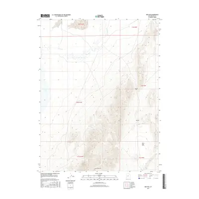
2017 Map of Red Pass
USGS Topo · Published 2017About this map
The Cricket Mountains dominate the southern half of this landscape, rising sharply from the surrounding basins in a series of ridge lines. This area represents a critical drainage point in the Great Basin, where the Sevier River flows toward its terminus at Sevier Lake. The map illustrates the hydrological patterns of the western desert before the river reaches the lakebed, showing the transition from riparian corridors to the open expanses of White Sage Valley. Navigational routes through the high terrain are established at Johnson Pass and the namesake Red Pass, providing the primary east-west corridors across the range. The township and range divisions, including t20s r9w and t21s r10w, reflect the systematic cadastral survey of these public lands within Millard County.
Find a feature on this map
12 named features on this map. Tap any name to fly to it.
Don’t see what you’re looking for? This feature index may not catch every label — zoom into the map to look around manually.
Map Details
Editions of this 2017 Red Pass Map
This is the sole edition of this map. No revisions or reprints were ever made.
Other maps of this area

1885 · Beaver
USGS Topo · 1:250,000

1885 · Sevier Desert
USGS Topo · 1:250,000

1908 · Fish Springs
USGS Topo · 1:250,000

1910 · Fish Springs
USGS Topo · 1:250,000

1953 · Richfield
USGS Topo · 1:250,000

1953 · Delta
USGS Topo · 1:250,000

1958 · Richfield
USGS Topo · 1:250,000

1958 · Delta
USGS Topo · 1:250,000

1962 · Delta
USGS Topo · 1:250,000

1971 · Red Pass
USGS Topo · 1:24,000