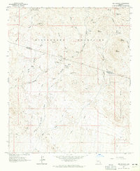
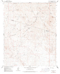
1964 Map of Red Picacho
USGS Topo · Published 1965About this map
Mining operations and remote desert camps define this mid-1960s landscape in the Wickenburg Mountains. The rugged terrain, spanning the Yavapai Co and Maricopa Co boundary, is marked by numerous prospect sites including the Great Southern Mine, Midnight Owl Mine, and White Cloud Mine. Small outposts like Pechan Camp provide a glimpse into the localized habitation patterns of this arid region, where life was often dictated by the proximity of water sources like Tub Spring and Spring.
Find a feature on this map
38 named features on this map. Tap any name to fly to it.
Don’t see what you’re looking for? This feature index may not catch every label — zoom into the map to look around manually.
Map Details
Editions of this 1964 Red Picacho Map
5 editions found
Other maps of this area

1887 · Prescott
USGS Topo · 1:250,000

1892 · Prescott
USGS Topo · 1:250,000

1903 · Bradshaw Mountains
USGS Topo · 1:125,000

1903 · Congress
USGS Topo · 1:125,000

1904 · Congress
USGS Topo · 1:125,000

1947 · Crown King
USGS Topo · 1:62,500

1947 · Wagoner
USGS Topo · 1:62,500

1948 · Crown King
USGS Topo · 1:63,360

1948 · Wagoner
USGS Topo · 1:63,360

1950 · Wagoner
USGS Topo · 1:62,500