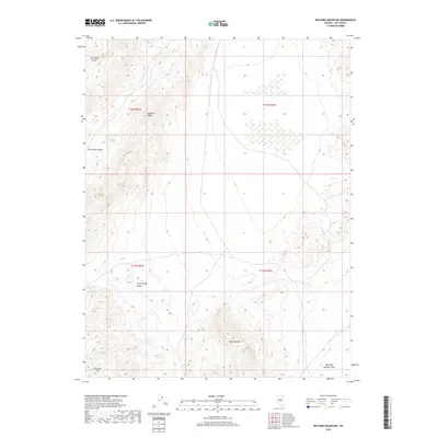
2018 Map of Red Ring Mountain
USGS Topo · Published 2018About this map
Red Ring Mtn serves as the central landmark for this high-altitude section of Nye County, where the topography shifts between the high Andesite Ridge and the broad alluvial expanses of the Little Smoky Valley. The geological character of the area is highlighted by the Rhyolite Hills in the southwest and the winding Pritchards Canyon to the west. While much of the terrain is defined by dry drainage features like Twin Piñon Gulch, the presence of Burnt Cabin Spring indicates a critical, if rare, water source for this landscape. The map effectively documents the transition from mountain ridges to the Big Sand Springs Valley, providing a clear view of the complex volcanic and desert geography typical of central Nevada's basin and range province.
Find a feature on this map
12 named features on this map. Tap any name to fly to it.
Don’t see what you’re looking for? This feature index may not catch every label — zoom into the map to look around manually.
Map Details
Editions of this 2018 Red Ring Mountain Map
This is the sole edition of this map. No revisions or reprints were ever made.
Other maps of this area

1956 · Lund
USGS Topo · 1:250,000

1956 · Tonopah
USGS Topo · 1:250,000

1959 · Tonopah
USGS Topo · 1:250,000

1960 · Lund
USGS Topo · 1:250,000

1962 · Tonopah
USGS Topo · 1:250,000

1967 · Moores Station
USGS Topo · 1:62,500

1967 · Moores Station
USGS Topo · 1:24,000

1967 · Chaos Creek
USGS Topo · 1:24,000

1968 · Portuguese Mtn
USGS Topo · 1:62,500
1968 · Brown Summit NW
USGS Topo · 1:24,000