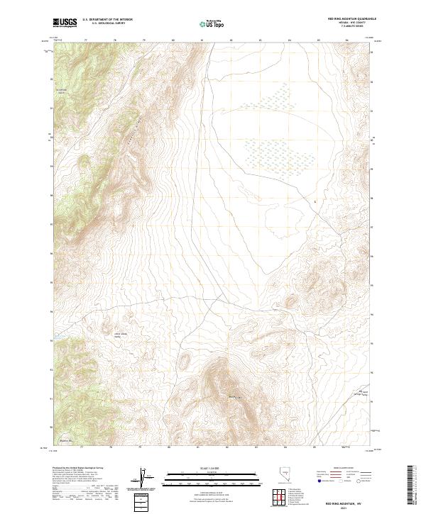
2021 Map of Red Ring Mountain
USGS Topo · Published 2021About this map
Andesite Ridge forms a prominent volcanic backbone through this corner of Nye County, dividing the high desert terrain into distinct basins. The western slopes descend toward Little Smoky Valley, where the isolated Burnt Cabin Spring provides a critical water source in an otherwise arid landscape. To the northeast, the terrain levels into the expansive Big Sand Springs Valley, while the southern reaches are dominated by the namesake Red Ring Mtn and the geologic formations of the Rhyolite Hills. This 2021 survey illustrates a remote section of Nevada defined by its stark geological features and traditional mining-era place names, such as Twin Piñon Gulch, which suggest the historical vegetation and prospecting character of the region.
Find a feature on this map
11 named features on this map. Tap any name to fly to it.
Don’t see what you’re looking for? This feature index may not catch every label — zoom into the map to look around manually.
Map Details
Editions of this 2021 Red Ring Mountain Map
This is the sole edition of this map. No revisions or reprints were ever made.
Other maps of this area

1956 · Lund
USGS Topo · 1:250,000

1956 · Tonopah
USGS Topo · 1:250,000

1959 · Tonopah
USGS Topo · 1:250,000

1960 · Lund
USGS Topo · 1:250,000

1962 · Tonopah
USGS Topo · 1:250,000

1967 · Moores Station
USGS Topo · 1:62,500

1967 · Moores Station
USGS Topo · 1:24,000

1967 · Chaos Creek
USGS Topo · 1:24,000

1968 · Portuguese Mtn
USGS Topo · 1:62,500
1968 · Brown Summit NW
USGS Topo · 1:24,000