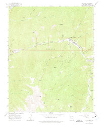
1963 Map of Red River
USGS Topo · Published 1975About this map
Red River occupies a narrow canyon floor in the 1960s, surrounded by the high peaks of the Carson National Forest. The mountain landscape is defined by its mining and recreational history, with multiple campgrounds such as Fawn Lakes Campground and June Bug Campground dotting the banks of the Red River. To the west, the Moly mining operations and associated Tailings Ponds near Sulphur Gulch indicate the industrial footprint of molybdenum extraction during this era.
Find a feature on this map
48 named features on this map. Tap any name to fly to it.
Don’t see what you’re looking for? This feature index may not catch every label — zoom into the map to look around manually.
Map Details
Editions of this 1963 Red River Map
2 editions found

Other maps of this area

1954 · Raton
USGS Topo · 1:250,000

1958 · Raton
USGS Topo · 1:250,000

1963 · Wheeler Peak
USGS Topo · 1:24,000

1963 · Eagle Nest
USGS Topo · 1:24,000

1963 · Arroyo Seco
USGS Topo · 1:24,000

1963 · Red River Pass
USGS Topo · 1:24,000

1963 · Cerro
USGS Topo · 1:24,000

1963 · Questa
USGS Topo · 1:24,000

1963 · Latir Peak
USGS Topo · 1:24,000

1963 · Comanche Point
USGS Topo · 1:24,000