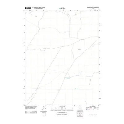
2010 Map of Red Rock Knoll
USGS Topo · Published 2010About this map
Red Rock Knoll and the surrounding high desert of Millard County are defined by a network of seasonal watercourses and strategic travel corridors. This 2010 survey illustrates the remote character of western Utah, where the Beaver River winds toward the Beaver Bottoms in the southeast. Water management is central to the area's utility, evidenced by the presence of Red Rock Number 1 Reservoir and Red Rock Number 2 Reservoir. Transportation across this arid landscape follows established routes like Crystal Peak Rd, which navigates through BlackRock Pass. The topography transitions from the drainage of Cedar Wash in the northwest to the distinct elevations of the Red Hills and Shorts Valley, providing a detailed look at the basin-and-range geography before it reaches the Sevier Lake basin.
Find a feature on this map
10 named features on this map. Tap any name to fly to it.
Don’t see what you’re looking for? This feature index may not catch every label — zoom into the map to look around manually.
Map Details
Editions of this 2010 Red Rock Knoll Map
This is the sole edition of this map. No revisions or reprints were ever made.
Other maps of this area

1885 · Beaver
USGS Topo · 1:250,000

1953 · Richfield
USGS Topo · 1:250,000

1958 · Richfield
USGS Topo · 1:250,000

1960 · Beaver Lake Mts.
USGS Topo · 1:62,500

1972 · Headlight Mtn
USGS Topo · 1:24,000
1972 · Sevier Lake SW
USGS Topo · 1:24,000

1973 · Black Rock
USGS Topo · 1:24,000

1973 · Read
USGS Topo · 1:24,000
1973 · Cat Canyon
USGS Topo · 1:24,000

1980 · Wah Wah Mts. North
USGS Topo · 1:100,000