
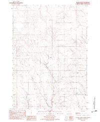
1982 Map of Red Scaffold
USGS Topo · Published 1983About this map
Red Scaffold serves as a focal point in this portion of the Cheyenne River Indian Reservation during the mid-1970s. The landscape is defined by the winding paths of Red Scaffold Creek and Cherry Creek, where small-scale water management is evident through features like Staple M Dam and Lacky Dam. Educational and ranching life are anchored by the White Swan Sch and family-named operations such as Red Coat Ranch and Budahl Ranch. The terrain is marked by distinctive geological formations like the Staple M Cliffs and practical land use ranging from a Gravel Pit to necessary infrastructure like Sewage Lagoons. This topographic study preserves the placement of isolated landmarks, including a solitary Grave, providing specific data points for those researching the rural development and genealogy of Ziebach County.
Find a feature on this map
19 named features on this map. Tap any name to fly to it.
Don’t see what you’re looking for? This feature index may not catch every label — zoom into the map to look around manually.
Map Details
Editions of this 1982 Red Scaffold Map
This is the sole edition of this map. No revisions or reprints were ever made.
Other maps of this area

1954 · Pierre
USGS Topo · 1:250,000

1955 · Rattlesnake Lake
USGS Topo · 1:24,000

1958 · Pierre
USGS Topo · 1:250,000

1982 · Chasing Hawk Draw
USGS Topo · 1:24,000

1982 · Dead Horse Draw
USGS Topo · 1:24,000

1982 · Bull Creek 2 NE
USGS Topo · 1:24,000

1982 · Bridger NE
USGS Topo · 1:24,000

1982 · Bessie Butte
USGS Topo · 1:24,000

1982 · Longbrake Ranch
USGS Topo · 1:24,000
1982 · Diermier Ranch
USGS Topo · 1:24,000