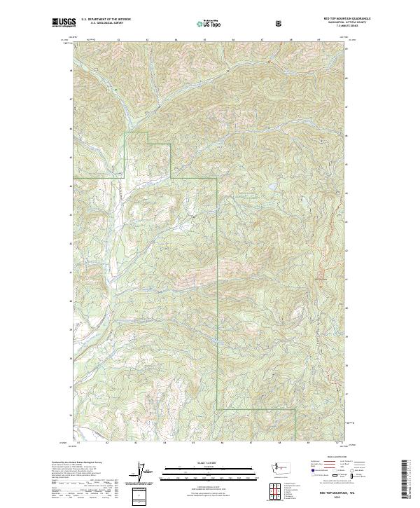
2023 Map of Red Top Mountain
USGS Topo · Published 2023About this map
Wenatchee National Forest encompasses the high country of the eastern Cascades shown here, defined by the prominent Wenatchee Ridge and Teanaway Ridge. The landscape is a network of steep drainages including Standup Creek, Stafford Creek, and the North Fork Teanaway River, which carves through the southwestern portion of the map. These waterways and ridges are accessed by a series of primitive routes such as Jack Creek Rd and Teanaway Rd, indicating a terrain utilized for forestry and backcountry recreation.
Find a feature on this map
38 named features on this map. Tap any name to fly to it.
Don’t see what you’re looking for? This feature index may not catch every label — zoom into the map to look around manually.
Map Details
Editions of this 2023 Red Top Mountain Map
This is the sole edition of this map. No revisions or reprints were ever made.
Other maps of this area

1897 · Mount Stuart
USGS Topo · 1:125,000

1902 · Mount Stuart
USGS Topo · 1:125,000

1957 · Wenatchee
USGS Topo · 1:250,000

1958 · Thorp
USGS Topo · 1:62,500

1958 · Cle Elum
USGS Topo · 1:62,500

1961 · Liberty
USGS Topo · 1:62,500

1961 · Mount Stuart
USGS Topo · 1:62,500

1975 · Wenatchee
USGS Topo · 1:100,000
1984 · Cle Elum
USGS Topo · 1:24,000
1985 · Swauk Prairie
USGS Topo · 1:24,000