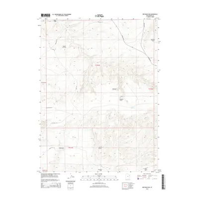
2014 Map of Red Wash NW
USGS Topo · Published 2014About this map
Horseshoe Bend Oil and Gas Field and several other major petroleum zones dominate this 2014 survey of Uintah County. The landscape is defined by extensive energy infrastructure, with a dense network of roads such as Pipeline 1 Rd and Stirrup Rd cutting across the desert terrain. This era represents a peak of industrial development in the Uinta Basin, where the Red Wash Oil and Gas Field and Wonsits-Wonsits Valley Oil Field sprawl across the township lines.
Find a feature on this map
24 named features on this map. Tap any name to fly to it.
Don’t see what you’re looking for? This feature index may not catch every label — zoom into the map to look around manually.
Map Details
Editions of this 2014 Red Wash NW Map
This is the sole edition of this map. No revisions or reprints were ever made.
Other maps of this area

1885 · Ashley
USGS Topo · 1:250,000

1907 · Jensen
USGS Topo · 1:125,000

1910 · Jensen
USGS Topo · 1:125,000

1917 · Vernal
USGS Topo · 1:125,000

1954 · Vernal
USGS Topo · 1:250,000

1958 · Vernal
USGS Topo · 1:250,000

1960 · Vernal
USGS Topo · 1:250,000

1964 · Brennan Basin
USGS Topo · 1:24,000
1964 · Ouray SE
USGS Topo · 1:24,000
1964 · Vernal SE
USGS Topo · 1:24,000