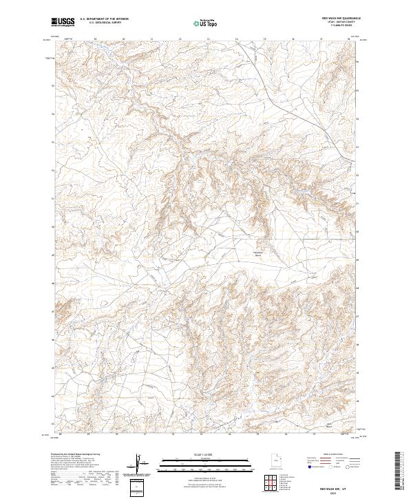
2023 Map of Red Wash NW
USGS Topo · Published 2023About this map
Deadman Bench dominates the central landscape of this Uintah County plateau, where a complex network of arid drainage systems defines the topography. The ephemeral Baser Wash cuts across the northern and eastern sections, while Antelope Draw and Glen Spring mark the southern reaches. This modern survey illustrates the persistent isolation of the high desert, showing a terrain primarily accessed by remote routes like Stirrup Rd. The map reveals the intricate contouring of the Glen Bench area, providing a precise look at the landforms as they existed in the early 2020s. Without significant settlements or industrial hubs, the sheet highlights the natural features and numbered land management routes that characterize this portion of the Uinta Basin.
Find a feature on this map
42 named features on this map. Tap any name to fly to it.
Don’t see what you’re looking for? This feature index may not catch every label — zoom into the map to look around manually.
Map Details
Editions of this 2023 Red Wash NW Map
This is the sole edition of this map. No revisions or reprints were ever made.
Other maps of this area

1885 · Ashley
USGS Topo · 1:250,000

1907 · Jensen
USGS Topo · 1:125,000

1910 · Jensen
USGS Topo · 1:125,000

1917 · Vernal
USGS Topo · 1:125,000

1954 · Vernal
USGS Topo · 1:250,000

1958 · Vernal
USGS Topo · 1:250,000

1960 · Vernal
USGS Topo · 1:250,000

1964 · Brennan Basin
USGS Topo · 1:24,000
1964 · Ouray SE
USGS Topo · 1:24,000
1964 · Vernal SE
USGS Topo · 1:24,000