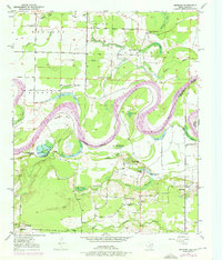
1950 Map of Redbank
USGS Topo · Published 1976About this map
The Red River meanders dramatically across this landscape, defining the state boundary between Arkansas and Texas. This 1950 survey, with revisions from the mid-1970s, reveals a floodplain dominated by complex oxbow lakes and sloughs, including the prominent Hudson Bow and La Voice Lake. The terrain transitions from the low Black Bottom in the south toward Smith Hill, where the small settlement of Redbank is situated.
Find a feature on this map
42 named features on this map. Tap any name to fly to it.
Don’t see what you’re looking for? This feature index may not catch every label — zoom into the map to look around manually.
Map Details
Editions of this 1950 Redbank Map
3 editions found
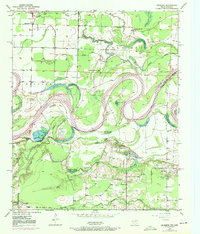
Other maps of this area

1909 · New Boston
USGS Topo · 1:62,500

1909 · Texarkana
USGS Topo · 1:62,500

1950 · Redbank
USGS Topo · 1:24,000

1950 · Ashdown West
USGS Topo · 1:24,000

1950 · Barkman
USGS Topo · 1:24,000

1951 · Redbank
USGS Topo · 1:24,000

1951 · Ashdown West
USGS Topo · 1:24,000

1951 · Barkman
USGS Topo · 1:24,000

1951 · Arden
USGS Topo · 1:24,000

1951 · Foreman
USGS Topo · 1:24,000