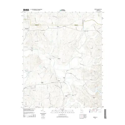
2014 Map of Redbud
USGS Topo · Published 2014About this map
Redbud and its surrounding rural communities are defined by the winding course of the Coosawattee River and the undulating terrain of the Red Bone Ridges in northern Georgia. The landscape is dotted with long-standing family and community hubs like Nickelsville, Fidelle, and Hunts Corner, connected by an intricate network of country roads. Transportation history is evident in the river crossings, including Pine Chapel Ferry Bridge, Owens Bridge, and Montgomery Bridge, which have historically facilitated movement across the water. The map shows the transition from the river lowlands to the higher ground of the ridges, where smaller settlements like Audubon and Decora are situated. Genealogical interests are served by the location of McEntire Cem, while the hydrology of the region is mapped through numerous drainages such as Salacoa Creek, Lick Cr, and the appropriately named Dry Cr.
Find a feature on this map
93 named features on this map. Tap any name to fly to it.
Don’t see what you’re looking for? This feature index may not catch every label — zoom into the map to look around manually.
Map Details
Editions of this 2014 Redbud Map
This is the sole edition of this map. No revisions or reprints were ever made.
Other maps of this area

1886 · Dalton
USGS Topo · 1:125,000

1890 · Cartersville
USGS Topo · 1:125,000

1891 · Cartersville
USGS Topo · 1:125,000

1892 · Dalton
USGS Topo · 1:125,000

1896 · Cartersville
USGS Topo · 1:125,000

1897 · Dalton
USGS Topo · 1:125,000

1914 · Talking Rock
USGS Topo · 1:62,500

1916 · Talking Rock
USGS Topo · 1:62,500

1941 · Adairsville
USGS Topo · 1:62,500

1944 · Adairsville
USGS Topo · 1:62,500