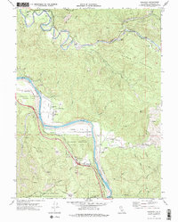
1969 Map of Redcrest
USGS Topo · Published 1974About this map
Humboldt Redwoods State Park dominates this late-sixties landscape, preserving massive groves like the Rockefeller Redwood Forest along the meandering course of the Eel River. The river valley serves as the primary corridor for human activity, where the Avenue of the Giants and the Northwestern Pacific railroad parallel the water. Small river-bottom settlements such as Redcrest, Holmes, and Shively are tucked between the banks and the steep timbered slopes of the Chalk Mountains. Local educational history is anchored by the Bluff Prairie Sch and Georgeson Sch, while the historic Strongs Station (Site) marks an earlier era of travel. To the north, the Van Duzen River carves through the terrain near Grizzly Creek Redwoods State Park, revealing a landscape shaped by both conservation and industrial needs like the Gravel Pits and Borrow Pit near the riverbanks.
Find a feature on this map
52 named features on this map. Tap any name to fly to it.
Don’t see what you’re looking for? This feature index may not catch every label — zoom into the map to look around manually.
Map Details
Editions of this 1969 Redcrest Map
2 editions found
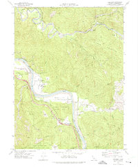
Other maps of this area

1919 · Glynn
USGS Topo · 1:62,500

1921 · Dyerville
USGS Topo · 1:62,500

1922 · Kneeland
USGS Topo · 1:62,500

1944 · Fortuna
USGS Topo · 1:62,500

1949 · Eureka
USGS Topo · 1:250,000

1949 · Weott
USGS Topo · 1:62,500

1950 · Iaqua Buttes
USGS Topo · 1:62,500

1950 · Scotia
USGS Topo · 1:62,500

1951 · Scotia
USGS Topo · 1:62,500

1951 · Weott
USGS Topo · 1:62,500