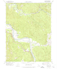
1969 Map of Redcrest
USGS Topo · Published 1974About this map
The Eel River and the Van Duzen River converge in this corner of Humboldt County, creating a landscape defined by deep river valleys and high timbered ridges. The Northwestern Pacific railroad follows the riverbanks, serving a series of small settlements and transit points like Redcrest, Holmes, and Pepperwood. This late-1960s survey illustrates the intersection of timber heritage and emerging conservation, as vast tracts are designated as the Rockefeller Redwood Forest and Humboldt Redwoods State Park.
Find a feature on this map
52 named features on this map. Tap any name to fly to it.
Don’t see what you’re looking for? This feature index may not catch every label — zoom into the map to look around manually.
Map Details
Editions of this 1969 Redcrest Map
2 editions found
Other maps of this area

1919 · Glynn
USGS Topo · 1:62,500

1921 · Dyerville
USGS Topo · 1:62,500

1922 · Kneeland
USGS Topo · 1:62,500

1944 · Fortuna
USGS Topo · 1:62,500

1949 · Eureka
USGS Topo · 1:250,000

1949 · Weott
USGS Topo · 1:62,500

1950 · Iaqua Buttes
USGS Topo · 1:62,500

1950 · Scotia
USGS Topo · 1:62,500

1951 · Scotia
USGS Topo · 1:62,500

1951 · Weott
USGS Topo · 1:62,500