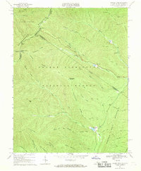
1967 Map of Reddish Knob
USGS Topo · Published 1969About this map
Shenandoah Mountain defines the high-altitude divide between Virginia and West Virginia in this late 1960s study, where the peaks of Reddish Knob and Pond Knob overlook a landscape dominated by the George Washington National Forest. This area of the Blue Ridge serves as a critical watershed, with the North Fork and South Fork of the Little River carving through steep ridges like Narrow Back Mountain and Wolf Ridge.
Find a feature on this map
49 named features on this map. Tap any name to fly to it.
Don’t see what you’re looking for? This feature index may not catch every label — zoom into the map to look around manually.
Map Details
Editions of this 1967 Reddish Knob Map
3 editions found
Other maps of this area

1892 · Franklin
USGS Topo · 1:125,000

1894 · Staunton
USGS Topo · 1:125,000

1896 · Franklin
USGS Topo · 1:125,000

1922 · Fort Seybert
USGS Topo · 1:48,000

1922 · Circleville
USGS Topo · 1:62,500

1924 · Circleville
USGS Topo · 1:48,000

1924 · Mc Dowell
USGS Topo · 1:62,500

1924 · Fort Seybert
USGS Topo · 1:62,500

1944 · Parnassus
USGS Topo · 1:62,500

1944 · Mc Dowell
USGS Topo · 1:62,500