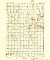
1899 Map of Redfield
USGS Topo · Published 1939About this map
The Chicago and Northwestern R. R. serves as the industrial backbone of this Central South Dakota landscape, connecting prairie settlements across Hand, Spink, Beadle, and Faulk counties. Surveyed in the late 19th century, the map reveals a meticulously gridded agricultural region where rail lines dictated the growth of towns like Redfield, Miller, and Tulare. The intersection of the Huron and Oakes Line with the Minn. and Central Dakota Line highlights Redfield as a critical transportation hub of the era.
Find a feature on this map
60 named features on this map. Tap any name to fly to it.
Don’t see what you’re looking for? This feature index may not catch every label — zoom into the map to look around manually.
Map Details
Editions of this 1899 Redfield Map
2 editions found
Other maps of this area

1895 · Byron
USGS Topo · 1:125,000

1895 · Aberdeen
USGS Topo · 1:125,000

1898 · Huron
USGS Topo · 1:125,000

1899 · Northville
USGS Topo · 1:125,000

1899 · Redfield
USGS Topo · 1:125,000

1950 · Ree Heights SE
USGS Topo · 1:24,000

1950 · Vayland
USGS Topo · 1:24,000

1950 · Wessington
USGS Topo · 1:24,000

1950 · Vayland NW
USGS Topo · 1:24,000

1950 · Wessington NE
USGS Topo · 1:24,000