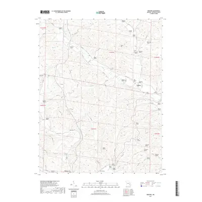
2017 Map of Redford
USGS Topo · Published 2017About this map
Redford and the northern outskirts of Ellington anchor this survey of the Missouri Ozarks, a landscape deeply defined by its intricate system of valleys and hollows. The terrain is characterized by winding watercourses such as Sinking Cr and Logan Cr, which have carved out distinctive local landforms like Spring Valley and Harrison Valley. For those researching local history, the map identifies several small burial grounds scattered throughout the hills, including the Old Redford Cem, Ratliff Cem, and Pyles Cem. The road network is a mixture of state routes and numbered county roads that follow the natural contours of the land, providing access to more remote locations like Camelite Hollow and Buzzard Hollow. This geographic record captures the rural character of Reynolds County, showing how physical features like Round Hill and Hill Pond remain primary identifiers for the local community.
Find a feature on this map
90 named features on this map. Tap any name to fly to it.
Don’t see what you’re looking for? This feature index may not catch every label — zoom into the map to look around manually.
Map Details
Editions of this 2017 Redford Map
This is the sole edition of this map. No revisions or reprints were ever made.
Other maps of this area

1928 · Cardareva
USGS Topo · 1:62,500

1943 · Ellington
USGS Topo · 1:62,500

1943 · Lesterville
USGS Topo · 1:62,500

1944 · Corridon
USGS Topo · 1:62,500

1945 · Ellington
USGS Topo · 1:62,500

1946 · Lesterville
USGS Topo · 1:62,500

1947 · Corridon
USGS Topo · 1:62,500

1949 · Rolla
USGS Topo · 1:250,000

1949 · Cardareva
USGS Topo · 1:62,500

1953 · Rolla
USGS Topo · 1:250,000