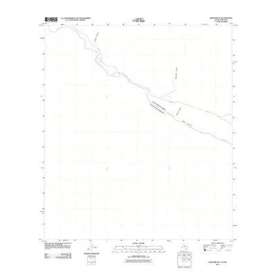
2011 Map of Redford SE
USGS Topo · Published 2011About this map
The Rio Grande serves as the defining international boundary through this high-desert corridor, separating the United States of America and Estados Unidos Mexicanos. This 2011 survey documents a remote stretch where the river carves through significant geological formations, including the deep incisions of Tapado Canyon and Rancherias Canyon. The landscape is dominated by these drainages, with Canyon Colorado and Closed Canyon also feeding into the river valley. Transportation is limited to the winding path of FM 170, which parallels the river's course. This map provides a clear view of the border topography just southeast of Redford, focusing on the natural desert features and the specific crossings of the drainage networks as they met the river before the most recent decade's developments.
Find a feature on this map
7 named features on this map. Tap any name to fly to it.
Don’t see what you’re looking for? This feature index may not catch every label — zoom into the map to look around manually.
Map Details
Editions of this 2011 Redford SE Map
This is the sole edition of this map. No revisions or reprints were ever made.
Other maps of this area

1896 · Polvo
USGS Topo · 1:125,000

1903 · Terlingua
USGS Topo · 1:125,000

1904 · Terlingua
USGS Topo · 1:125,000

1931 · Lajitas
USGS Topo · 1:62,500

1959 · Emory Peak
USGS Topo · 1:250,000

1959 · Presidio
USGS Topo · 1:250,000

1965 · Presidio
USGS Topo · 1:250,000

1965 · Emory Peak
USGS Topo · 1:250,000
1971 · Redford SE
USGS Topo · 1:24,000
1971 · Agua Adentro Mountain
USGS Topo · 1:24,000