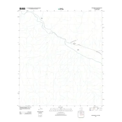
2012 Map of Redford SE
USGS Topo · Published 2012About this map
The Rio Grande snakes through the high desert of the West Texas borderlands, carving a deep natural boundary between the United States and Mexico. This landscape is defined by the significant topographic relief of the Trans-Pecos, featuring several prominent drainages such as Tapado Canyon and Rancherias Canyon. Much of the northern terrain is protected within Big Bend Ranch State Park, preserving a wilderness where few modern structures exist. The only significant transportation corridor is Ranch Road 170, which follows the river's winding course through the lower elevations. The map provides a clear look at the geological formations that create obstacles like Closed Canyon, illustrating the remote and arid nature of the river valley in the early 21st century.
Find a feature on this map
6 named features on this map. Tap any name to fly to it.
Don’t see what you’re looking for? This feature index may not catch every label — zoom into the map to look around manually.
Map Details
Editions of this 2012 Redford SE Map
This is the sole edition of this map. No revisions or reprints were ever made.
Other maps of this area

1896 · Polvo
USGS Topo · 1:125,000

1903 · Terlingua
USGS Topo · 1:125,000

1904 · Terlingua
USGS Topo · 1:125,000

1931 · Lajitas
USGS Topo · 1:62,500

1959 · Emory Peak
USGS Topo · 1:250,000

1959 · Presidio
USGS Topo · 1:250,000

1965 · Presidio
USGS Topo · 1:250,000

1965 · Emory Peak
USGS Topo · 1:250,000
1971 · Redford SE
USGS Topo · 1:24,000
1971 · Agua Adentro Mountain
USGS Topo · 1:24,000