
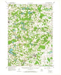
1961 Map of Redgranite
USGS Topo · Published 1963About this map
Glacial geology defines the central Wisconsin landscape of this 1961 survey, where numerous kettle lakes and gravel deposits supported a mix of recreation and industry. The village of Redgranite and neighboring Lohrville are surrounded by extensive Quarries, indicating the area's history as a hub for stone production. Transportation through the southern portion of the quadrangle is anchored by the Chicago and North Western railroad, which served the industrial sites near Spring Lake.
Find a feature on this map
98 named features on this map. Tap any name to fly to it.
Don’t see what you’re looking for? This feature index may not catch every label — zoom into the map to look around manually.
Map Details
Editions of this 1961 Redgranite Map
2 editions found
Other maps of this area

1915 · Neshkoro
USGS Topo · 1:48,000

1916 · Ripon
USGS Topo · 1:48,000

1918 · Neshkoro
USGS Topo · 1:62,500

1918 · Ripon
USGS Topo · 1:62,500

1955 · Green Bay
USGS Topo · 1:250,000

1956 · Ripon
USGS Topo · 1:62,500

1956 · Weyauwega
USGS Topo · 1:48,000

1957 · Amherst
USGS Topo · 1:48,000

1957 · Waupaca
USGS Topo · 1:48,000

1957 · Madison
USGS Topo · 1:250,000