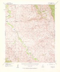
1957 Map of Redington
USGS Topo · Published 1961About this map
The San Pedro River serves as the central artery for this remote Arizona corridor, anchoring a network of family ranches and small settlements in the late 1950s. The map documents the persistent human presence in the valley, from the clustered buildings at Redington and Cascabel to the isolated Cascabel School. These communities are defined by the geography of the surrounding Galiuro Mountains and Winchester Mountains, where numerous canyons like Redfield Canyon and Hot Springs Canyon drain toward the river basin.
Find a feature on this map
84 named features on this map. Tap any name to fly to it.
Don’t see what you’re looking for? This feature index may not catch every label — zoom into the map to look around manually.
Map Details
Editions of this 1957 Redington Map
3 editions found

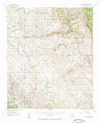
Other maps of this area

1904 · Tucson
USGS Topo · 1:125,000

1905 · Tucson
USGS Topo · 1:125,000

1911 · Winkelman
USGS Topo · 1:125,000

1913 · Winkelman
USGS Topo · 1:125,000

1938 · Galiuro Mts
USGS Topo · 1:48,000

1940 · Sierra Bonita Ranch
USGS Topo · 1:62,500

1942 · Sierra Bonita Ranch
USGS Topo · 1:62,500

1943 · Galiuro Mts
USGS Topo · 1:62,500

1943 · Dragoon
USGS Topo · 1:62,500

1943 · Sierra Bonita Ranch
USGS Topo · 1:62,500